
Relevant News and Articles

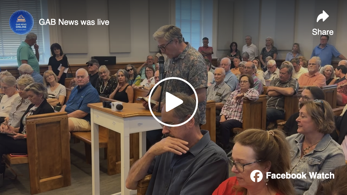
Plans for a development in Georgetown’s historic district, where shrimpers once docked and centuries-old buildings overlook the Sampit River, are on hold indefinitely.
A request to rezone 3.4 acres across seven parcels on Front and Cannon streets would have allowed for a development with housing, commercial buildings and possibly a hotel. However, the request was withdrawn ahead of a Nov. 20 Georgetown City Council meeting.
Georgetown County Council has given second reading approval to a request to rezone 113 acres located off of Highway 521, about one mile east of 9-mile curve.
Property owner Diane Welch wants the property rezoned from General Commercial (GC) and One-Half Acre Residential (R1/2Ac) to 6,000 Sq. Ft. Residential (R-6) & Conservation Preservation (CP).

The city bought the property in August 2023 from the old Liberty Steel Mill, and renovations are set to begin Oct. 1.
Mayor Carol Jayroe and Mayor Pro Tempore Jim Clements held a news conference Wednesday afternoon at the new city hall, which sits at 420 South Hazard St.
Mayor Carol Jayroe explained how the city has been seeking to fill a void that’s been empty since 2011, when a sinkhole forced staff to move out of their original headquarters.
“The city believes in this area, and we are ready to mark our spot here,” Jayroe said.

In the mid-2000s, Maryville Partners planned and developed that parcel of land into 292 lots within an aptly-named neighborhood called Craven’s Grant. They then built roads and curbs, entitled the land, planted oak trees, installed water and sewer pipes and erected gates.

A developer intends to purchase the idled Liberty Steel mill as part of a plan to redevelop Georgetown’s waterfront, state and local officials said.
State Rep. Lee Hewitt, R-Murrells Inlet, and Georgetown Mayor Carol Jayroe recently met with the developer to discuss plans for a mixed-use project on the land. The developer, who hasn't been identified, specializes in revitalizing former industrial sites, Hewitt said.
GEORGETOWN — Georgetown County wants to purchase three pieces of land owned by International Paper as part of its effort to redevelop waterfront property in the longtime industrial hub, local officials said.
No specific plans for the property have been presented, but County Administrator Angela Christian said the county would like to pursue a large-scale redevelopment that includes the nearby county-owned port.
“When you grow that fast, the amount of police, the amount of schools, the amount of fire, the amount of roads, your infrastructure has to keep up,” Haynie said. “So, we slowed growth to a manageable point.”

Shoaling in the harbor limits access even for recreational boats.
Work is moving forward on a plan to dredge the Georgetown harbor, although the actual work to deepen the channel is still more than a year away.
“To get to the dredging, we’ve got to do some studies and preliminary work,” said Mark Messersmith, the project manager for the Army Corps of Engineers’ Charleston District.
GEORGETOWN, S.C. (WCSC) - Hundreds of Georgetown County residents will be out of a job by the end of the year after International Paper announced it would be closing its mill.
The company announced Thursday morning that it would be closing the doors to its Georgetown pulp and paper mill, shutting it down in stages with a complete closure expected by the end of 2024.
Design Guidelines: Many municipalities in South Carolina have design guidelines for new development within historic districts, outlining specific architectural styles, materials, and other requirements to ensure that new construction complements the existing historic fabric.

This is an important informational event. If you want the FACTS about the Proposed Georgetown County Land Use Plan & Maps that will guide zoning and land use decisions in the Waccamaw Neck for the next TEN YEARS, please attend this forum and bring a neighbor or friend.
Land use lawsuits most commonly occur in situations where plaintiffs claim they are receiving unequal treatment. A common cause of such a lawsuit is “spot zoning.” In the 1963 case Bob Jones University, Inc. v. City of Greenville, the SC Supreme Court invalidated “spot zoning,” which it defined as giving a small land parcel a classification entirely unlike the zoning for surrounding areas in a way that benefits the owners of that property and harms other property owners.

Plans for a housing development near the Georgetown County Airport face turbulence after aviation officials raised concerns about planes flying too close to rooftops.
Known as South Island Landing, the project would turn nearly 29 acres of undeveloped woods along the city’s southern border into 274 homes at the intersection of Old Charleston Road and U.S. Highway 17.

According to documents, if approved, the city will assume ownership of this new sewer easement and will become responsible for its sewer line operation and maintenance in perpetuity.
The development, when complete, will contain 18 single-family lodging units and a commercial space adjacent to the Motel 6
Today it was announced the production of wire rod will end June 19 – at least temporarily – and the plant will produce wire mesh and welded steel products.
This will result in the layoff of 50 of the mill’s 79 workers, according to a Liberty Steel press release.
Company leaders say the move is necessary because “current market forces, along with a surge in imported steel, have led to a decrease in rod prices, causing the mill to incur higher production costs than the selling price of the rod.”
By a 5-1 vote, Georgetown County Council has approved a rezoning request and a change to the county’s comprehensive plan that will allow 27 homes to be built on eight acres of land adjacent to The Hammock Shops in Pawleys Island. Councilman Bob Anderson cast the only “no” vote to the proposals. The vote was to amend the comprehensive plan from Conservation Preservation to Medium Density Residential.
The new development will be called Magic Oaks.

Eighteen years after it was first introduced to the Georgetown County Planning Commission, Crown Pointe is now expected to become a reality.
Crown Pointe is a mixed-used planned development located along both sides of Highway 51 extending east to Highway 701 from Pringle Ferry north to David Ray Road.
It contains 1,716 acres. In 2010 it was approved for 3,244 residential units as well as commercial space.
Through the years, various zoning changes took place in the Crown Pointe area, but no construction took place.
Chief among those is a new, elevation-based zoning map. In the lowest of the city's districts, which are the most vulnerable to flooding, the new strategy recommends reducing development density, and supporting provisions that boost natural "green" systems to absorb and filter rising waters. Simultaneously, the update calls for incentivizing more density and development, including affordable housing, on higher ground.

If it is built it will be called The Wharf and will be in the land area adjacent to the parking lot at the Carroll Ashmore Campbell Marine Complex at the south end of the Maryville Bridge.
On Tuesday night, the Georgetown Planning Commission approved a request to annex and rezone a tract of land near the boat landing to Master Planned Residential.
Last spring, the Georgetown City Planning Commission approved a request from D.R. Horton, Inc. to build 274 homes in multiple phases in Maryville between South Island Road and Highway 17.
But now the development called South Island Landing is being challenged by Georgetown County and the South Carolina Aeronautics Commission (SCAC) because of the property’s proximity to the Georgetown Airport.


In 2017, Georgetown City Council approved a request to rezone 10 acres of land between the Black River and two hotels along Church Street to allow for a fishing village. But the development has not yet happened.
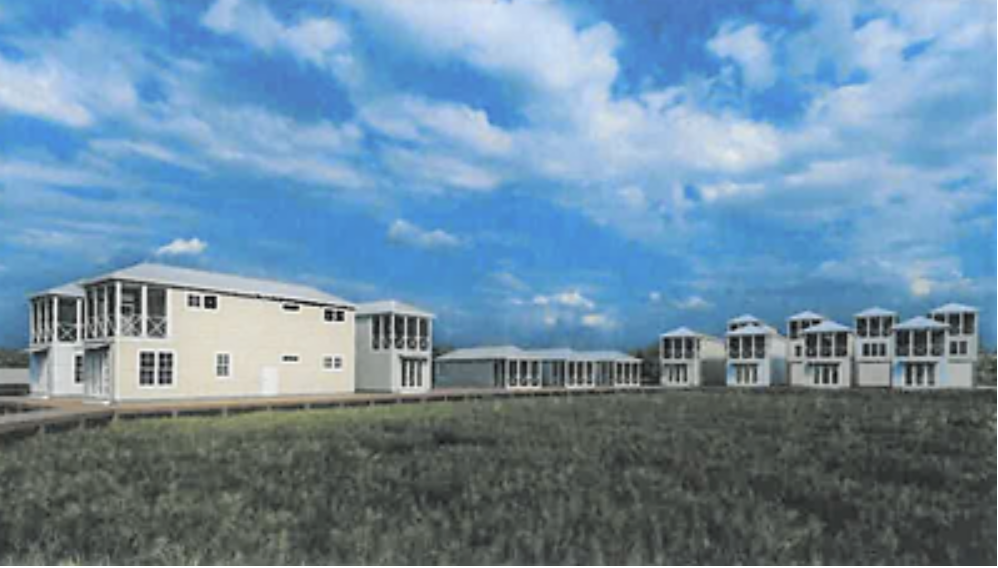
This week the owners of the property – 711 Partners LLC – are bringing the request back to council to get an amendment.The plans are for 18 single-family units (1-2 bedrooms) each to be built on the property between the Quality Inn and the Baymont Inn on Church Street. Each of the units will be about 650 square feet in size.
These will be rental units, not permanent residences.
Big changes could be coming to the main thoroughfares in the City of Georgetown because of the passage of the much planned and talked about Urban Core Overlay District (UCOD).
The new zoning ordinance for UCOD passed second and final reading by Georgetown City Council unanimously Thursday evening. The new zoning impacts Highway 17, Highway 701 and Highmarket Street within the city limits. An overlay district allows cities to tighten or relax zoning rules in the areas designated without having to change an entire zoning ordinance.
While PUDs can be an excellent tool for managing the development of large tracts of land, there can also be drawbacks to their use. For example, inexperienced municipalities may be misled by presentations of plans or may simply be eager to build up the tax base and haphazardly approve development (Dover, 1996).
Georgetown City Council was supposed to hold just one meeting in December, but it was announced this morning that a special meeting will be held next week.
According to information from Georgetown City Clerk Stephanie Buccione, the purpose of the meeting will be to "review and amend city ordinances."